Executive Summary
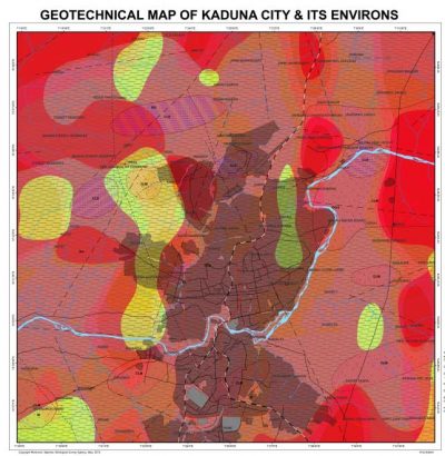
Production of Geotechnical maps showing:
Areas suitable and unsuitable for housing projects,
Areas suitable for waste disposal and
Areas susceptible to flooding.
The method of study involved field geological mapping, shallow borehole drilling/testing and laboratory analysis. The laboratory geotechnical tests carried out on the soils included: particle size distribution, Atterberg limits, unconsolidated undrained triaxial, compressibility, permeability, shear box and pH.
The entire project area is underlain by Precambrian migmatite-gneiss complex which constitutes the largest portion of the area followed by the Pan African granitoids (the second largest) and lastly, the metasediments/metavolcanics which are mostly schists. The soils derived from these rocks are gravelly clays, sandy clays, clays and clayey gravels. Gravelly clays cover about 33% (208km2) of the area, sandy clays, about 6% (37 km2) clays about 41% (256 km2), clayey gravels about 6% (37/cm) and alluvial silty clays, about 12% (80 km2).
The geotechnical and physico-chemical properties of the various soil types are presented below:
Reddish-brown to red, stiff to hard, residual lateritic gravelly clays and Reddish-brown to red, stiff to hard residual lateritic sandy clays.
Low to medium plasticity, low compressibility, (<0.1 m2/MN), medium permeability (10-3 – 10-5m/s), very low to low swelling potentials, and high bearing capacities (>150 kN/m2) at shallow depth. Good foundation materials.
Reddish-brown to red, stiff to hard residual lateritic clays.
Low to medium plasticity, low compressibility (<0.1 m2/MN), low permeability (10-5 – 10-7m/s), very low to low swelling potentials, and high bearing capacities (>150 kN/m2) at shallow depth. Good foundation materials.
Reddish brown to red, medium dense to dense residual lateritic clayey gravels.
Low to medium plasticity, low compressibility (<0.1 m2/MN), high permeability(>10-3m/s), very low to low swelling potentials, and high bearing capacities (>150 KN/m2) at shallow depth. Good foundation materials.
Grey to brown, soft to firm, alluvial silty clays.
Low to medium plasticity, low compressibility (<0.1 m2/MN), low permeability (10-5 – 10-7m/s), very low to low swelling potentials, and low bearing capacities (<150 KN/m2) at shallow depth. Poor foundation materials.
The soils in the study area can generally be classified as CIG, GCL and CLS according to the British system of soil classification and as GC and SC according to Unified Soil Classification system.
The streams constitute the main flood paths during the rainy season when they overflow their channels and the flood zones are the flood plains and the Fadama areas along Rivers Kaduna, Gora Kura and their tributaries. Flooding affects about 10% (65 km2) of the study area. The entire soils are slightly acidic (pH = 5 or 6) and therefore do not pose any serious engineering, environmental or agricultural problems.
The soil geotechnical properties and the topography were jointly used to produce the following land use maps showing areas:
i. Suitable for housing estate development (about 79% of study area).
ii. Suitable for waste disposal (about 5% of study area).
iii. Susceptible to flooding (flood risk areas) (about 10% of study area).
iv. Indicating different landform types.

