NGSA acquires Triple Quadrupole Inductively Coupled Plasma Mass Spectrometry (TQ-ICP-MS)

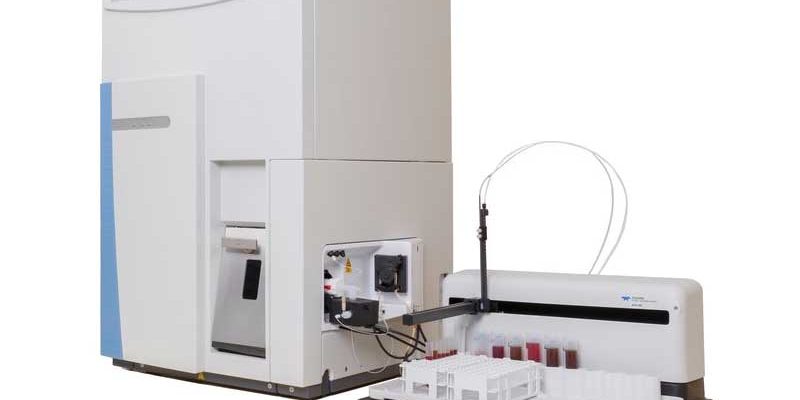
NGSA has recently acquired a state-of- the-art Analytical equipment (TQ-ICP-MS) through the MinDiver Project and is in the process of installing the equipment at its headquarters in Abuja. The Thermo Scientific iCAP TQ-ICP-MS is a high performance ICP-MS utilizing triple quadrupole technology for ultra trace quantification of elements in a variety of challenging matrices, it…

Read more

Litho-structural Map of Nigeria

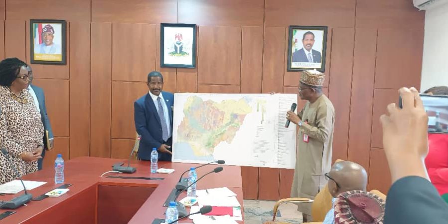
“The new 1:2 million scale Litho-structural map of Nigeria represents a significant update and approach to mapping and the understanding of Nigerian Geology. It also provides a foundation for understanding the tectonic evolution of Nigeria and its Mineral Systems. This map is one of the most notable updates from previous iterations of the National Map.…

Read more

Geophysical Investigation of Copper Deposit in Azara Area, Nasarawa State

The impediment to economic growth and the challenges of mono-economy has prompted the Federal Government of Nigeria (FGN) to generate interest and develop urgent policies on rejuvenation of the solid mineral industry in order to diversify the economy (Alabi et al., 2016). Solid minerals of different varieties are largely available in Nigeria, these cuts across…

Read more

Geotechnical Mapping of Makurdi and its Environs

Executive SummaryThe collapse of buildings is a re-occurring disaster in several Nigerian cities for many years, resulting in the loss of lives and properties. This explains the rationale for this project undertaken by the Nigerian Geological Survey Agency with the following major objectives and deliverables: Produce engineering geological maps which can be used to select…

Read more

Geotechnical and Engineering Geological Investigation of Owerri and Its Environs

Executive SummaryThe geotechnical and engineering geological investigation of Owerri and its environs had been studied. The project covered an area of 625km2 encompasses Owerri and environs. The focus of the research was to investigate the subsoil in order to determine its engineering properties, its suitability as foundation for industrial and residential houses. It was also…

Read more

Geotechnical Mapping of Benin City and Its Environs

Executive SummaryBuilding collapses have become a recurring incidence in many parts of Nigeria.In view of contributing to the forestalling of future occurrences, the Nigerian Geological Survey Agency (NGSA) as part of its statutory role had embarked on a systematic Geotechnical mapping of the major cities in Nigeria. This is aimed at providing relevant geotechnical information…

Read more

Geotechnical / Engineering Geological Mapping of Sokoto and Its Environs

Executive SummaryThe geotechnical/ engineering geological mapping of Sokoto and Its environs is a positive step of the Nigerian Geological Survey Agency to attempt to address the present problems of foundation and other structural failures rampant in the burgeoning Nigerian cities. It will also generate data bank of the geotechnical properties of soils in all the…

Read more

Geotechnical and Engineering Geological Investigation of Aba, Abia State and Its Environs

Executive SummaryThe phenomenal rise in the number of reported cases of collapsed buildings in the country with its attendant loss in revenue and human lives has been a cause for concern to well-meaning Nigerians. As part of its constituted mandate, the Nigerian Geological Survey Agency in 2006 commenced a systematic engineering geological mapping of selected…

Read more

Geotechnical Mapping of Kaduna and its Environs

Executive SummaryThe collapse of buildings and flooding are re-occurring disasters in several Nigerian cities, including Kaduna, for many years, resulting in the loss of lives and properties. This explains the rationale for this project undertaken by the Nigerian Geological Survey Agency with the following major deliverables and objectives: Production of Geotechnical maps showing: Areas suitable…

Read more

Engineering Geological Mapping of Gombe and its Environs

Executive SummaryThe geotechnical and engineering geological investigation of Owerri and its environs had been studied. The project covered an area of 625km2 encompasses Owerri and environs. The focus of the research was to investigate the subsoil in order to determine its engineering properties, its suitability as foundation for industrial and residential houses. It was also…

Read more

Regional Gravity Survey of Enugu State

Abstract: A regional gravity survey of Enugu State was carried out in order to produce Bouguer anomaly, Free-air anomaly and the Elevation map of the State for mineral exploration.Acquisition of gravity data as a tool for mineral exploration is useful because gravity differences or anomaly reflect lateral density variation in rocks extending to several kilometres…

Read more

A Report on The Geotechnical Mapping Of Kaduna and Its Environs

The collapse of buildings and flooding are re-occurring disasters in several Nigerian cities, including Kaduna, for many years, resulting in the loss of lives and properties. This explains the rationale for this project undertaken by the Nigerian Geological Survey Agency with the following major deliverables and objectives:Production of Geotechnical maps showing:Areas suitable and unsuitable…

Read more