This map is one of the most notable updates from previous iterations of the National Map. It is the presentation of a detailed structural architecture that is a reflection of the tectonic evolution of Nigeria
The previous map versions did not utilize the national airborne magnetic and radiometric data, as a consequence, the structural geometry of Nigeria has not been well captured.
The fundamental goal of this mapping program was to map the regional structural architecture through Nigeria. This provides a basis for building an understanding of the tectonic development which will provide a framework for understanding the mineral systems in Nigeria.”
. . . Dr Abdulrazaq Garba, Former Director General (2019 – 2024)
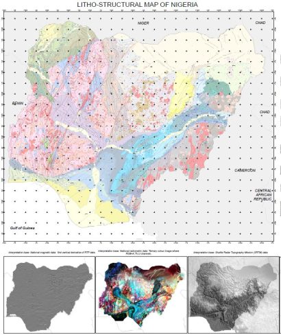
• The delineated Basement Domains and sub-domains that make-up the Pan-African igneous-metamorphic basement
• Phanerozoic Basins
• Bida Basin rift axis
• High strain domains within the Benue Trough
The Litho-Structural map will provide a foundation for the development of the following which will also be provided for public use soon:
• NGSA Bulletin detailing the Litho-structural mapping and the resulting understanding of the tectonic evolution of Nigeria
• National 1:2 million scale Metallogenic Map
• Benue Trough Architecture and Metallogenic Map
• Detailed Basement Domain maps